Sunday, October 16, 2011

Walpole

Thursday 13th October
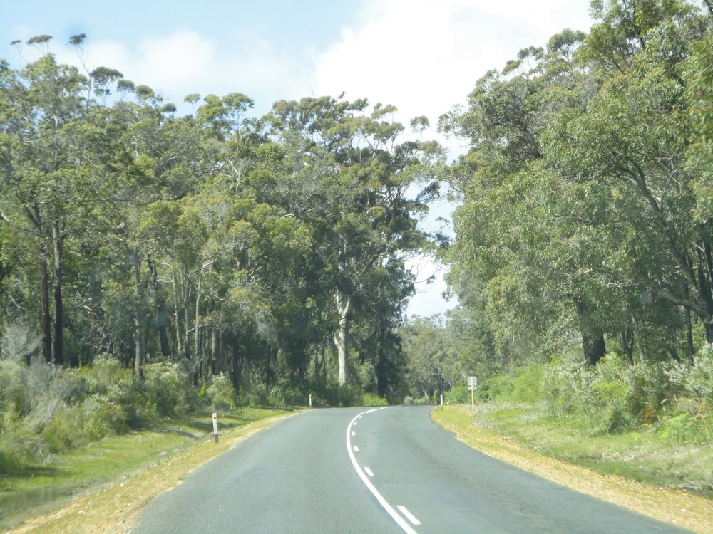
All the area around Pemberton and Walpole is covered with Karri Forest National Parks.  We had some fairly heavy rain during the night which eased off to showers by the morning allowing us to hook up the van without getting wet. The road was fairly hilly and windy for the whole way from Pemberton to Walpole.

Walpole is a small township on an inlet, on the southern-most coast of Western Australia. Our motor camp is about 2km east of town right on the edge of the inlet. After setting up camp we headed for the Valley Of The Giants and its Tree Top Walk, about 17km away.
The Tree Top Walk is made up of long steel trusses about 60metres in length starting at ground level and reaching up to a height of 40 meters as it meanders for 600 meters through the giant Tingle and Karri Trees.  Both the Tingle and Karri Trees are a form of Eucalyptus, and both can grow to over 70 meters in height.  It takes a lot of getting used to the huge size of these trees.


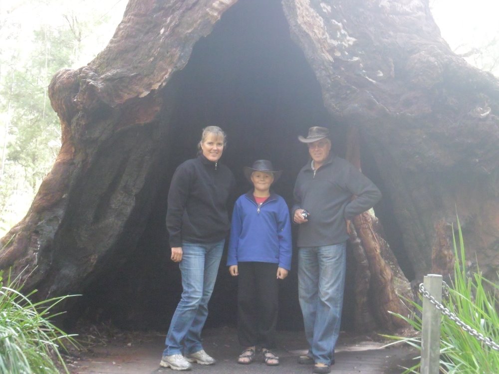
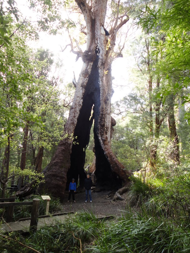
We enjoyed the walk so much we did it twice.  After the tree top walk we did another walk the Walk among Giants, on the ground among the trees.  Tingle trees have a peculiar trait in that a lot of them split at the base and end up with holes right through them, some big enough to walk through.


From there we drove to another part of the forest to view the biggest Tingle tree in the world.  It was standing among several other similar sized trees, and again the size of these forest giants never fails to amaze.


From there we drove into Walpole and had a look at the town before heading back to our camp.  Just as a matter of interest, there are four Kiwi or ex Kiwi families camped around us.  There’s a heck of a lot of kiwis in this area of Australia.
Tomorrow we will continue our journey east and travel to Albany, about 130 km away.

Friday, October 14, 2011

Pemberton

Wednesday 12th October
Besides its gigantic Karri trees, Pemberton also advertises a 9km tram ride along an old railway track through the karri Forests.  We decided to give it a go, so after a lazy morning fronted up at the Railway station at 10.30 along with about 100 other tourists. The tram comprised three separate carriages and they were all soon full.
The driver was a real comedian and kept us all well entertained with an excellent commentary on the history of Pemberton, its milling history, and descriptions and names of the various trees that made up the forest as we trundled along the track.


This combined with his rather dry jokes about the rather sad state of disrepair of the old wooden trestle bridges as we approached them made the trip thoroughly enjoyable, if not a bit scary for some of the kids on board.
After a late lunch back at the caravan we headed off to explore Big Brook Dam which supplies Pemberton with its water.  The dam itself was surrounded by Karri Forest, and its setting reminded us very much of Lake Mangamahoe near New Plymouth. 
We did the 4 km walk around the lake and then headed back to town for a well earned beer at the Pemberton Hotel.
Back at the caravan we were joined by about 10 Port Lincoln Parrots, also known as 28’s, who were more than happy to help Cameron eat his sandwich.  A bit like the Crimson Rosellas we met at Tarra – Bulga National Park in our very first week in Australia.  Port Lincoln parrots are quite common in South Western Australia, but this was the first time we had ever been this close to them.


Tomorrow we will continue southeast to Walpole which is on the southern coast, where we hope to do another tree top walk.  From there we will carry on to Albany before heading to Esperance and then up to the Nullabor.

Wednesday, October 12, 2011

Gloucester Tree

Tuesday 11th October
The Gloucester Tree, about 3 km from Pemberton, was used as a Fire Lookout from about 1947.  It was part of a network of 8 similar trees that were used as a means of early detection of forest fires.  Today there are only 3 of them left, and they are a major tourist attraction for the Pemberton area, tempting people to climb them.  
A lookout platform was built high in the tree, and in the case of the Gloucester Tree, the platform is 61 meters above the ground. Access to the lookout is via a spiral staircase of steel rods driven into the trunk of the tree.  Not a climb to be undertaken by the faint hearted or those scared of heights.  The Gloucester Tree was the main reason we headed for Pemberton this morning.
Most of the area from Busselton to Pemberton is covered with Karri forest, and we had a very scenic drive through the forests and lush farmland.


Karri trees frequently grow to more than 60 meters in height and we saw plenty of these giants on our drive. Karris have been growing in this area of Australia for hundreds of years.  Most of the wooden sleepers used on New Zealand’s Railway Lines were cut from Karri trees from this area.  It is known for its hardness and ability to last for a long time.
Pemberton is a small saw milling township founded on the Karri Tree.  It is set on the side of a hill surrounded by Karri Forest.  Quite a picturesque setting. 

We had read quite a bit of literature on the Gloucester Tree and we all decided climbing it was one of the things we had to do while in Aussie. 
After setting up camp and having lunch we headed to the tree.  There were a few people sitting around on the seats below the tree staring up at it.  Away up in the branches, just about out of sight, we could see the lookout platform.  One look at the steel spike ladder disappearing up into the branches high above our heads, and Christel and I looked at each other and gulped.  What the hell had we let ourselves in for?
A notice said only 6 people were allowed up on the lookout platform at any one time. After ascertaining that there was no one up the tree and with no other excuses available, we set off.  Cameron first, followed by Christel, with me coming up the rear as a safeguard and to help reassure the others should their nerve give out.

The steel spikes were about 40cms apart, and the only safety fence was some flimsy wire netting.  The pictures clearly show it.  The rescue and backup crew at the rear managed about 8 steps before his nerve gave out and he gingerly climbed back down.  Christel managed about 8 more before she too started carefully backing down.  That left Cameron on his own.
The two big cowards, with their feet firmly planted on the ground looked at each other.  Do we tell him to come back or let him go?  What if he freezes somewhere up there?  Who would rescue him?  Cameron meanwhile was happily giving a running commentary as he climbed higher and higher.  He was well aware that his ‘support crew’ were no longer with him, but obviously wasn’t bothered.  We were.

The steel rods were so far apart he had to climb them one at a time getting both feet on to each rod before moving up to the next.  Higher and higher he went, while we watched with our hearts in our mouths, and our feet tingling.  Soon another guy also started the climb, and with his longer legs, soon caught up to Cameron.  We could hear them chatting to each other as they disappeared from sight behind the tree and then emerged again as they spiralled up.


He finally disappeared onto the platform and then we heard him shout “I’m at the highest point”.  Great.  Now all he’s got to do is get back down.  After about 5 minutes we were starting to think his nerve had finally given out and we were going to have to launch a rescue mission, when his feet appeared below the platform and he was on his way back down.
By now there were about a dozen people gathered around the base of the tree all aware that a 9 year old boy was up there.  As he started coming down I yelled out “How’s it going mate?”. His reply of “I’m fair shitting myself” had everyone in stitches.


A few minutes later a very proud boy joined his equally proud parents on the ground.  A remarkable achievement for him.  He had the good grace not to give his parents a hard time.

Another lookout tree, called the Dave Evans Bicentennial Tree, was about 20km away and was shown as being even higher with its lookout 68 meters above ground.  It too was accessed by a spiral steel rod staircase, but this one had a platform 25 meters up where you could stop and rest. We decided this would be much easier, so off we went.


We won’t go into Cameron’s parents’ second failure of the day.  Cameron got up to the first platform, but was complaining about a sore leg, so decided to go no further.  Thank goodness.  This one looked even worse than the Gloucester Tree.  We won’t even mention how far Christel and I got.


We then drove to another part of the Karri forests to look at the Beedelup waterfall and walk amongst these giants of the forests.  Brilliant stuff.  


Thank goodness the early settlers didn’t cut down everything in their search for timber. Then it was back to camp for a celebratory drink for Cameron’s achievement.  Whatever happened to our little boy?

Tuesday, October 11, 2011

Leeuwin-Naturaliste National Park

Saturday 8th October
It is only 65 km from Bunbury down to Busselton.   If you look at a map of Australia, Busselton is at the very bottom of the fish hook that forms Geographe Bay about 200km south of Perth.  At the point of the fish hook is Cape Naturaliste which we intend to visit from Busselton.
As mentioned earlier, the countryside and roads around this area are very similar to New Zealand.  Busselton is right on the coast, and is the main town of a long chain of small villages that all run into one another and stretch out for miles along the coast.  It all has the feeling of sleepy seaside towns, with several flash new retirement villages springing up.

Our motor camp is about 100 meters from the beach on the main road about 8 km south of Busselton.  After setting up camp and having lunch, we drove down into town to the water front, to go for a walk along its famous 1.8km jetty.  At the end of the jetty is an underwater observatory which we wanted to visit.  Judging by the thousands of people both on the jetty and around the restaurants at the shore end, the jetty and observatory were obviously very popular attractions.
As part of the attraction, a small train takes passengers from the shore out to the observatory at the end of the jetty. To get access to the jetty, you had to first of all buy a ticket at a ticket office.  We got to the jetty at about 2.00 o’clock and joined the queue, only to be told there were no available spaces until the 4.00 o’clock tour, which didn’t finish until about 5.45pm.  As the weather was looking a bit threatening we decided to leave it for the day, and instead booked tickets for the 9.00 o’clock tour tomorrow.
We decided to fill in our time by looking around town for a while, and then, because the weather was looking so threatening, headed back to the caravan and watched the England vs France Rugby World cup game.  After that we went for a walk along beach and while doing that, the weather finally broke and we got caught in the start of heavy rain and thunderstorms which lasted all night.  Our first thunderstorm since being in Australia.
Sunday 9th October
Thankfully by morning the storm had blown itself out and we woke up to clear blue skies. 9.00 o’clock saw us on the jetty, and we were soon chugging along the 1.8km out to the observatory.  The observatory is like a huge round concrete water tank with windows.  It was made on shore then floated out to the end of the jetty were it was flooded and sunk to the ocean floor.  It was then anchored to the ocean floor and pumped dry.  It is in 8 meters of water and you descend on a spiral staircase to the bottom. 

There are windows at various levels as you go down, so you can see different sea life at different levels.  

It is set among the old jetty piles which are covered with barnacles and such like which attract fish.  While we were there a huge school of yellow tail mullet was hanging around, as well as lots of other fish, crabs and jelly fish. 


A fascinating experience, probably even better than seeing huge sharks and stingrays in an aquarium, as the fish we were looking at were all in their natural habitat.  Why can’t New Plymouth do something like this?

After the observatory we drove around town and then out to the Geographe Marina where we ogled at all the million dollar plus houses with their equally expensive yachts moored at their front doors. On the way to the marina we passed an Ibis Rookery, with thousands of these big birds roosting and nesting in a few trees.  The stink was almost overpowering.  You certainly wouldn’t want to live downwind.  
Then it was back to the caravan to watch the quarter finals of the World Cup, accompanied by beer and chips and dip.  We didn’t know whether to cheer for the Springboks or the Aussies in the first game, but had no problems with the second game.  Go the All Blacks.
Monday 10th October
This morning we headed out to Cape Naturaliste lighthouse at the western most tip of Geographe Bay.  We had a very interesting tour which included climbing up inside the lighthouse and learning all about the hard life of the early lighthouse keepers.  The reflectors for the 1000 watt light are made of lead crystal, and are valued at $11,000,000.


In the old days there were three lighthouse keepers employed at all times to ensure the light kept working.  They had to wind the clockwork mechanism about every 45 minutes.  Today the light is turned by a small electric motor.  The whole revolving head weighs about 9 tons and floats in a bath of mercury.

From the Cape Naturaliste Lighthouse, we drove south for about 100km along the coast through the Leeuwin – Naturaliste National Park towards the Leeuwin Lighthouse at the south-western end of the park.  Between them, the two lighthouses mark the most south western corners of the Australian mainland. On the way we drove through some beautiful countryside and bush land.


This area is part of the famous Margaret River wine producing region, and we passed some really flash looking wineries.

We took a short side road out to Hamelin Bay near the very south western corner of Aussie, and sat on the beautiful beach and had our lunch.

From there we drove on to the small town of Augusta on the south coast, and then on to the Cape Leeuwin Lighthouse, which marks the extreme south western corner of Australia, and is also the point where the Indian and Southern Oceans meet.  The guy at the information desk at the lighthouse told us the wind blows there 360 days of the year, and today was one of them.  Great place for a wind farm!!!


From there we drove back to Busselton via the inland road through the Wine Town of Margaret River.  On the way we decided we couldn’t pass through this famous wine growing region  without sampling some of the local produce, so called in at a couple of Wineries.
The first one we stopped at was really flash, and they gave us some tiny sample tastes of their produce which we both thought tasted something like battery acid mixed with horse piss.  No wonder New Zealand wines sell so well in Australia.
We rushed on to the next one hoping to wash the horrible taste out of our mouths.  This was a much more ordinary looking establishment and their wine was lovely, although it took us about 5 lots of sampling to get the taste of the first one out of our mouths.  Although we are not big wine drinkers, we staggered out with three bottles, and continued our trip back to Busselton.  A real neat day’s sightseeing. 
Tomorrow we will leave the west coast of Aussie after first seeing it at Derby on the 24th July, and start heading east towards Melbourne to complete our round trip.  Our first stage will be south east to Pemberton about 150 km away for our next adventure.